San Gabriel River of the Angeles National Forest (CA)
January 17, 2005
Late afternoon.
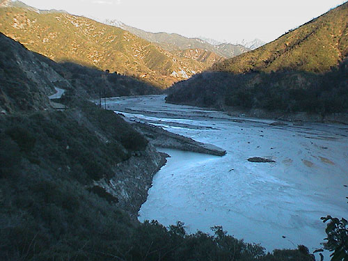
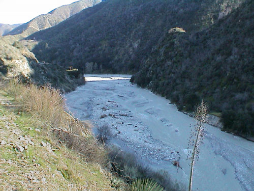
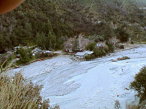
Looking in a general easterly direction into the mouth of East Fork.
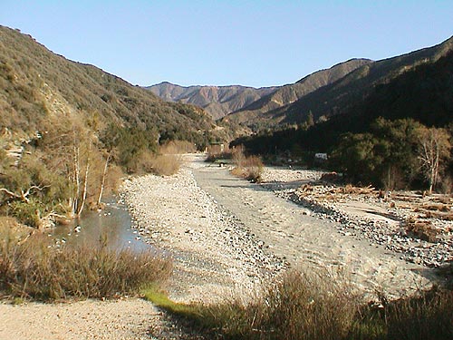
West of Follows Camp looking eastward towards the camp.
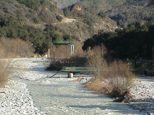
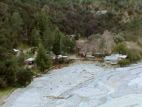
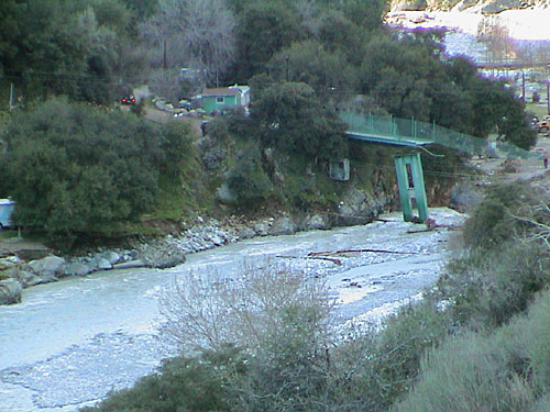
Receding flood waters reveal erosion of dirt roadway leading
to Follows Camp's main entrance bridge (in foreground).
About 5 foot deep & 30 foot width of rock removal under
bridge, and trench over a mile long will be necesary to
return the river to its pre-flood location and allow for
the free passage of fish.
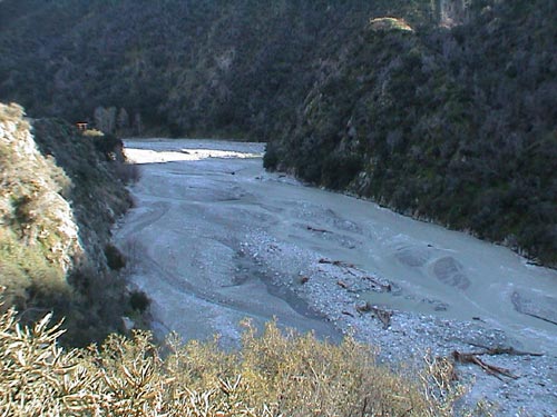
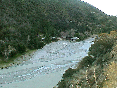
The East Fork River's new multiple paths extends
across what was a large dirt covered campground
which was about 6 feet above the river's level.
Looking eastward towards Follows Camp's eastern boundary (mid-photo).
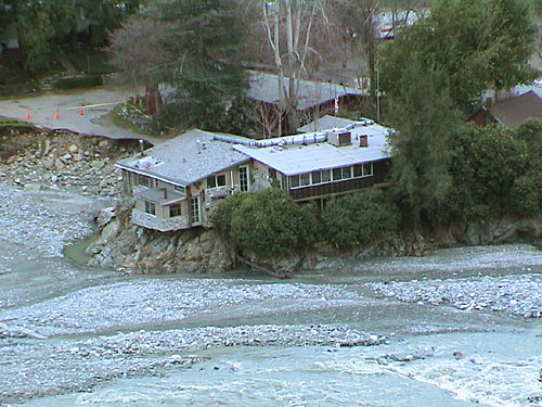
Heavy erosion damage.
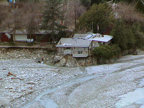
House and pavement undermined by flooding.
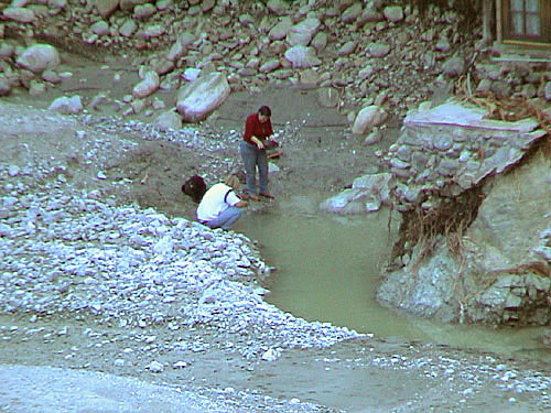
Stranded residents pass the time panning for placer gold.
After a flood is an excellent time for prospecting as gold is unearthed
by raging waters and is carried down stream where it is often deposited
in alluvial soil and geographic traps (as shown above) where the flood
water's velocity is slowed causing the gold to drop.
Devastation of Follows Camp's camping sites by the stripping of all soil
leaving only rough rocks to pitch a tent and set up chairs.
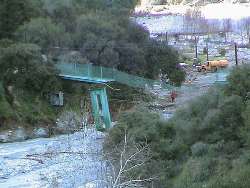
Raging water seriously tweeked one of the bridge's support
pylons approximately 90-degrees.
Shown below bridge is a small trolley seat in which supplies
and a few people (owners) were transported across the river.
Trolley is considered unsafe for regular personal transport.
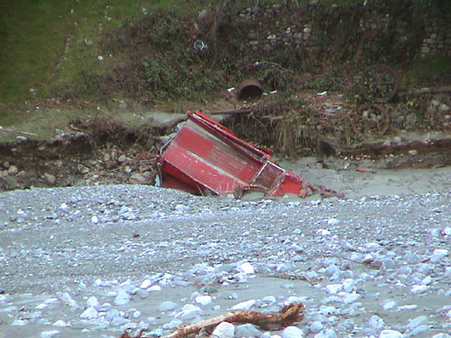
Looking upon top of Follows Camp Volunteer Fire Department's hose/pumper fire truck.
East Fork Road, Follows Camp, Camp Williams, flooding, National Forest, San Gabriel River.