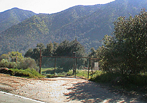
At the middle (gated) access road to Follows Camp from the East Fork Road, at an elevation of 1600 feet above mean sea level, is one
of the County of Los Angeles Department of Public Works' ALERT (Automatic Local Evaluation in Real-Time) raingages.
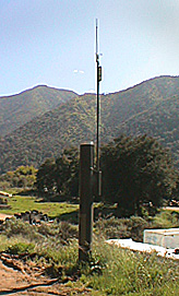
62 of these raingages are plotted on a Near Real-Time Precipitation Map.
The link below directs you to the
accumulated Season Totals which you can adjust to other time durations (top bar above map). Posting of updated figures sometimes
seem to lag a bit, hence the term: "Near Real-Time."
The S.G. @ East Fork
raingage can be found on the center, far right of the
map.